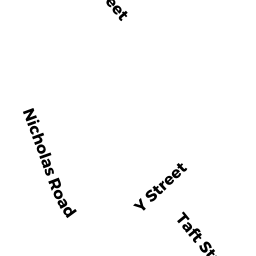
67 TAFT ST
Owner Information
FONSECA MICHAEL C - TRUSTEE
67 TAFT ST
MILFORD, MA 01757


Property Details
67 TAFT ST is classified as a Single Family Residential (Split ent).
The primary structure on this property was built in 1969. There are 1,925ft2 of built area within this property. There is 1,925ft2 of residential/living space within this property. This property is listed as having 6 rooms.
67 TAFT ST is valued at $370,800. The land is valued at $137,500 and the structures are valued at $232,700. There is an additional valuation of $600 on this property.
This property is in Zone RB. Confirm with local Zoning Board authorities to ensure there are no overlays or other easements on this property.
The most recent deed for 67 TAFT ST is recorded at the local registrar in Book 48346, Page 6. 67 TAFT ST was last sold on Friday, December 30, 2011 for $100.
Assessment data from fiscal year 2022.
Flood Data
According to the FEMA National Flood Hazard Layer, this property does not appear to be in a flood zone. It may also be in an area not yet reviewed. Nonetheless, confirm this information prior to taking any action.
To view the flood hazards around this property, create a FEMA "Firmette" Map of the area around 67 TAFT ST.
Broadband Internet Providers
| Provider | Type | Bandwidth (mbps) | |
|---|---|---|---|
| HughesNet | Satellite | 25 | 3 |
| Crown Castle Fiber | Fiber | 0 | 0 |
| Viasat Inc | Satellite | 100 | 3 |
| Verizon New England Inc. | DSL | 7 | 0 |
| Verizon New England Inc. | Fiber | 940 | 880 |
| Comcast | Cable | 1000 | 35 |
| GCI Communication Corp. | Satellite | 0 | 0 |
| VSAT Systems, LLC. | Satellite | 2 | 1 |
Broadband service provider data from December 2020.
Adjacent Properties
- 65 TAFT ST
Single Family Residential owned by DRINAN KEVIN S - 94 HIGHLAND ST
Single Family Residential owned by CHASE BARBARA A CHASE DARRELL A - 92 HIGHLAND ST
Single Family Residential owned by SANTIAGO LESLIE - 90 HIGHLAND ST
Single Family Residential owned by NORTON JEFFREY - 71 TAFT ST
Single Family Residential owned by WESTERMAN AARON M